It is currently Sat Apr 20, 2024 12:36 am


 Page 1 of 1 [ 2 posts ] 
Author Message
 Post subject: mapping a x-country flight
PostPosted: Mon Apr 04, 2011 12:27 pm 
User avatar

Joined: Wed Jul 16, 2003 1:16 am
Posts: 2586
Location: Ottawa
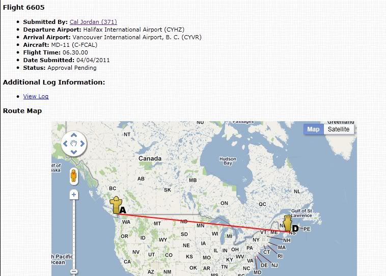
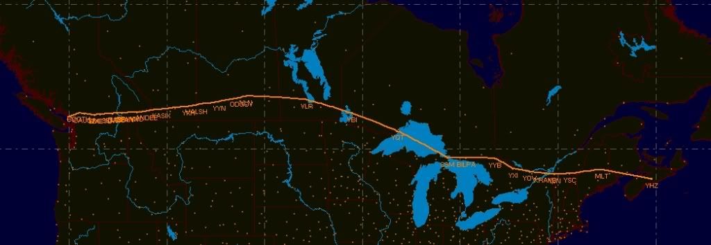
I was clicking around and came across this map of a recent flight taken on CVA and wondered what it really looked like.

The ACARS point-to-point map....
Image

A map of the route from FSCommander....
Image

cheers


_________________
CVA (established in 1997) is 23 years old this year!
Image Image
Offline
 Profile  
 
 Post subject: Re: mapping a x-country flight
PostPosted: Mon Apr 04, 2011 4:07 pm 
User avatar

Joined: Sat Mar 08, 2008 7:59 pm
Posts: 1016
Location: Kelowna, BC
Too bad the ACARS map wouldn't show all the waypoints also.


_________________
Not using FSX anymore, using only FS2020 and some flights with VR (Oculus)


Image....Image
Offline
 Profile  
 
Display posts from previous:  Sort by  
 Page 1 of 1 [ 2 posts ] 


Who is online

Users browsing this forum: No registered users and 3 guests


You cannot post new topics in this forum
You cannot reply to topics in this forum
You cannot edit your posts in this forum
You cannot delete your posts in this forum

Search for:
Jump to:  

cron